Tompkins Center for History and Culture Renovation Update, 3/2019

25 03 2019

The Tompkins Center for History and Culture is on track to open in a few weeks. I have not seen a specific date, but it will be sometime in April.

I stopped by to take a few quick photos, when The History Center’s Executive Director (and candidate for town of Ithaca supervisor) Rod Howe opened the door and asked if I wanted a tour. Unfortunately, it was not going to work with my schedule that day. Luckily, a sneak peak of the interior can be found on the TCHC’s Facebook page.

***

Throwback time. This photo comes courtesy of Terry Harbin. This was once the 100 Block of North Tioga (across the street from the TCHC. The Blood Building, 109-113 North Tioga, was built in 1870 and also known as the Old Masonic Block.

This photo appears to come from the mid 1960s. For one, the Cornell library to the north (left) has been demolished, and that happened in 1960. For two, the car in the foreground is a 1963 Plymouth Fury, which had a unique slantback front end (growing up in a family of mechanics had to come in handy for something). The car behind it is a 1963 Chevrolet, since most Chevy models upgraded to three tail lights on each side for 1964, and that body style was ’62-’64 only. The truck, eh, not so good with, I don’t remember so many of those in my family’s shops. It’s a Chevy in the same mid 1960s time frame.

Even in Ithaca’s salty winters, the cars probably outlived the building. It would come down in 1966 and, several years later, be replaced by the new Bank Tower addition, which was built from 1974-75. The little third-floor addition on top of that came along in the early 1980s. You can still its outline on Bank Tower’s north face.

Also, note the building that once stood where the Seneca Garage is. It was a last ditch effort to revive downtown, but Urban Renewal removed a lot of tired but attractive buildings that Ithaca and many other communities are trying to recreate (in form if not necessarily style) today.


South Meadow Square Construction Update, 3/2018

23 03 2018

One doesn’t have to look far to see retail is taking in on the chin. Wikipedia has a well-sourced listicle of events in the “retail apocalypse“, as it’s been branded by the national media outlets. Several factors play into the spike in retail chain bankruptcies and closures across the country – the rise of Internet shopping (Amazon) and easy, cheap distribution, Wal-Mart and other megachains exerting economies of scale on other retailers can’t afford to sell as cheaply, younger generations buy less “stuff”, the United States simply has too much retail space.

For now, some retailers are more immune than others – those who focus on convenience and budget necessities (dollar stores), those who sell goods that are hard to ship (home improvement stores, wholesale clubs), and those who focus on experiences rather than items. However, even sectors that were once seen as safe as starting to feel the pinch – pharmacies and grocery stores, for instance.

With all that in mind, it seems a bit odd to be building new suburban “big-box” retail space, but Buffalo-based Benderson Development is doing just that at South Meadow Square at 742-744 South Meadow Street on the city’s southwest side. Benderson purchased the retail strip from the original developers (the Visnyei family) in 2009.

Development of Ithaca’s big-box corridor has always been contentious. Long ago, the area consisted of a few small auto-centric businesses and the county fairgrounds (hence Fairgrounds Memorial Parkway). During the mid and late 20th century, big box retail slowly made its way into the southwest part of the city – what’s now Finger Lake Reuse on Old Elmira Road was built as a grocery store in the 1970s, and parts of Ithaca Plaza next door date to 1950. Wegmans opened a store in the 1980s, and replaced with newer, larger store in 1997.

The 1990s was when big-box development pressure seemed to come to a head. Wal-Mart was stymied for years thanks to neighborhood opposition, and Target eventually gave up its plans and moved to Lansing. But, much to the city’s chagrin, the 1990s were difficult times economically – the tax base was in decline, state aid was in decline, and the local economy was mired in a deep recession. Somewhat begrudgingly, the Nichols (1989-1995) but especially the Cohen administration (1995-2003) began permitting large-scale retail development in the hopes of propping up the tax base and stemming the flow of dollars to suburban outlets in the suburbs, as well as Elmira and Cortland.

Many of the  city’s big boxes are result of that late 1990s/early 2000s wave. Wal-Mart (2005, expanded to a Supercenter in 2011), Home Depot (2003), the Tops Placa (2002). Some were all-new, others were extensive renovations and rebuilds. This particular retail strip at 742-744 is one of the latter – it had actually opened as a rather large 87,000 SF K-Mart in the 1970s (the 22,000 SF supermarket it shared a lobby with later became Staples), and was extensively renovated and in the mid-1980s and in more recent years. The K-Mart looked pretty dated when it closed in October 2011. Hobby Lobby filled some of the old K-Mart space in 2013, and in fall of that year, plans were drawn up for a pair of endcap expansions.

One was on the north end – 7,315 SF of retail space, next to the early 2000s 19,000 SF PetSmart. The other was a 14,744 SF south endcap that would be built were K-Mart’s garden center used to be. These plans were approved in November 2013, but then updates and revisions were proposed in 2014, when TJ Maxx and Five Below were announced to fill the remaining vacant space (21,770 SF and 8,209 SF respectively). At that time, the southern addition became 16,200 SF.

For one reason or another, Benderson decided to go back to the original plan (probably a potential tenant backed out) early last year, and asked for re-approval of the November 2013 additions – city approval is only good for two years. Unlike most parts of the city, the lack of nearby residents and general apathy towards big-box retail makes variances somewhat easier to receive; plus, a re-approval is typically a small matter – re-approval was granted in May. City zoning (SW-2, and PUDOD) is generous down here because the city keeps hoping someone will do walkable mixed-use, but the waterlogged soils make that difficult – you either build shallow, or quite deep, and quite deep requires a lot of height and square footage above ground to make up those construction costs.

Construction is going to be fairly standard – concrete slab foundation, steel frame, masonry walls, and probably some decorative entry bays and facade work. At the moment, excavation is underway for the footers of the foundation on the southern end, while the footers have already been poured and strengthened with rebar on the northern end. The Dryvit and brick veneer on the wall of Pet-Smart has been removed, and I think that’s mineral wool insulation underneath. Expect both of these to be finished towards the end of the year. I don’t have a project value offhand, but the existing plaza (128,582 SF) is $6.5 million, so 22,059 SF of new space is probably worth about $1 million or so.

As for tenants, your guess is as good as mine. We’ll see if Benderson can make it work in the age of the retail apocalypse. Benderson’s proffered choice of designers, Buffalo’s Carmina Wood Morris D.P.C., is the architect.

November 2017

January 2018

March 2018


The Maplewood Redevelopment, Part I: History and Planning

28 08 2017

Being as large and complex as it is, it was hard to figure out a way to present the Maplewood project clearly and coherently. After some thinking, it seems the best combination of clarity and detail will be to split it into three sections. This section, Part I, will be an overview of the site history and project planning. Part II will examine and break down the site plan with all of its contributing structures. Part III will be the regular construction update, which will be bi-monthly just like all the others.

Quick primer note – Maplewood Park was the name of the old complex. The new one is just called “Maplewood”. With the shorthand for Maplewood Park being Maplewood, it can get confusing.

Let’s start with the background. Love it or not, Cornell University is one of the major defining organizations of the Ithaca area. It employs nearly 10,000 people and brings billions of dollars in investment into the Southern Tier, Tompkins County and Ithaca. That investment includes the students upon which the university was founded to educate.

Traditionally, neither founder Ezra Cornell nor first university president Andrew Dickson White were fans of institutional housing. Their preference was towards boarding houses in the city, or autonomous student housing (clubs, Greek Letter Orgs, etc), where it was felt students would learn to be more independent. This mentality has often underlain Cornell’s approach to housing – it’s not a part of their primary mission, so they only build campus housing if they feel it helps them meet academic and institutional goals. If many potential students are opting for other schools because of housing concerns, or the university is under financial strain because it has to subsidize high housing costs in their scholarships, then Cornell is motivated to build housing in an effort to improve its situation and/or become more competitive with peer institutions.

With that in mind, being one of the top-ranked schools in the world means that, in the historical context of the university’s goals and plans, new housing is rarely a concern. Cornell will update housing in an effort to be more inclusive and to improve student well-being, but with labs, classrooms and faculty offices taking precedence, building new housing is rarely an objective. Only about 46% of undergrads live on campus, and just 350 of over 7,500 graduate and professional students.

From 2002 to present, Cornell has added 2,744 students, with a net increase in Ithaca of about 1900. The net increase in beds on Cornell’s Ithaca campus during that same time period is zero. While Cornell did build new dorms on its West Campus, they replaced the University “Class of” Halls. 1,800 beds were replaced with 1,800 beds. In fact, the amount of undergraduate and graduate housing on campus had actually decreased as units at Maplewood Park and the law school Hughes Hall dorm were taken offline, either due to maintenance issues, or for conversion to office/academic space. When the announcement for further decreases came in Fall 2015, I wrote a rare Ithaca Voice editorial, and even rarer, it brought Cornell out to the proverbial woodshed for poor planning and irresponsibility.

To be fair, while Cornell was the guilty body, removing housing isn’t a problem on its own. It’s when the local housing market can’t grow fast enough to support that, that it becomes a problem. The Tompkins County market is slow to react, for reasons that can be improved (cumbersome approvals process) and some that can’t (Ithaca’s small size and relative isolation poses investment and logistical hurdles). In the early and mid 2000s housing was added at a decent clip, so the impacts were more limited. But housing starts tumbled during and after the recession, and it was unable to keep up. As Cornell continued to add students in substantial quantities, it became a concern, both for students and permanent residents.

By the mid-2010s, Cornell was faced with financial strains, student unhappiness and worsening town-gown relations, all related to the housing issue. As a result, the past couple years have become one of those rare times where housing makes it close to the top of Cornell’s list of priorities.

In weighing its options, one of the long-term plans was to redevelop the 17-acre Maplewood Park property. The property was originally the holdings of an Ellis Hollow tavern keeper and the Pew family before becoming the farmstead of James and Lena (sometimes Lyna) Clabine Mitchell in the early 1800s. In 1802, James was passing through from New Jersey to Canada with plans to move across the border, but stopped in the area, liked it, and bought land from the Pews, then moving the rest of his family up to Ithaca. Apparently there’s a legend of Lena Mitchell attacking and killing a bear with a pitchfork for eating her piglets. Many of the home lots in Belle Sherman were platted in the 1890s from foreclosed Mitchell property.

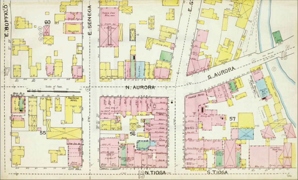
Like many of the Mitchell lands, it looks like the property was sold off around 1900 – a Sanborn map from 1910 shows a brick-making plant on the property along the railroad (now the East Ithaca Rec Way) and not much else for what was then the city’s hinterland. It’s not clear when Cornell acquired property, but by 1946, Cornell had cleared the land to make way for one of their “Vetsburgs”, also known as Cornell Quarters. The 52 pre-fabricated two-family homes were for veterans with families, who swelled Cornell’s enrollment after World War II thanks to the GI Bill. Once the GIs had come and gone, Cornell Quarters became unfurnished graduate housing, geared towards students with families, and international students.

The Cornell Quarters were meant to be temporary, and so was their replacement. In 1988-89, the university built the modular Maplewood Park Housing, with 390 units/484 beds for graduate and professional students, and an expected lifespan of 25 years. The intent was to replace them with something nicer after several years, but given Cornell’s priorities, and housing typically not among them, it fell to the back burner. As temporary units with marginal construction quality and upkeep, poor-condition units were closed off in later years, and capacity had fallen to about 356 beds when the complex’s closure was announced in May 2015 for the end of the 2015-16 academic year.

Cornell had long harbored plans to redevelop the Maplewood site – a concept schematic was shown in the 2008 university Master Plan. After weighing a renovation versus a rebuild with a few possible partners, the university entered into an agreement with national student housing developer EdR Trust to submit a redevelopment proposal. The partnership was announced in February 2016, along with the first site plan.

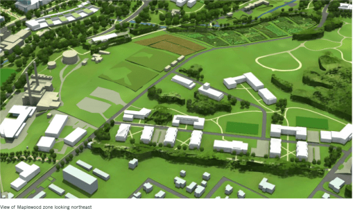
The core components of the project were actually fairly consistent throughout the review process. The project would have 850-975 beds, and it would be a mix of townhouse strings and 3-4 apartment buildings, with a 5,000 SF community center to serve it all. The project adheres to New Urbanist neighborhood planning, which emphasizes walk-ability and bike-ability, with interconnected and narrow streets, and parking behind buildings rather than in front of them. Energy-efficient LEED Certification was in the plans from the start.

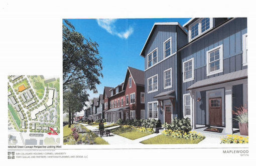
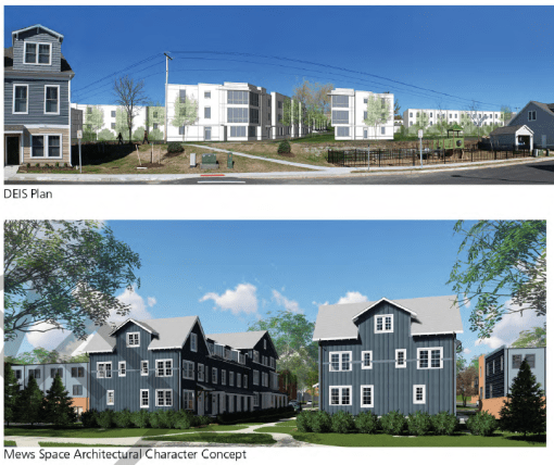
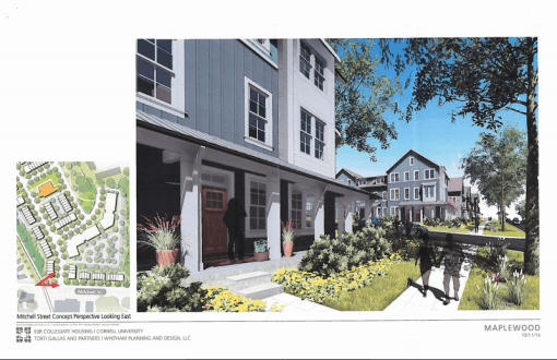
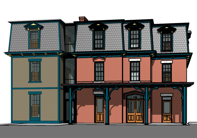
However, the overall site plan did evolve a fair amount, mostly in response to neighbor concerns raised through the review process. Many residents on or near Mitchell Road were uncomfortable with multi-story buildings near them, so these were pulled further back into the complex, and late in the process the remaining Mitchell Street multi-story buildings were replaced with very-traditional looking townhomes with a smaller scale and footprint. More traditional designs were also rolled out for the pair of townhouse strings closest to Worth Street, since neighbors noted they would be highly visible and wanted them to fit in. The building planned in the city’s side was also pulled inward into the parcel early on due to neighbor concerns – it became an open plaza and bus stop. The university was fairly responsive to most concerns, although the most adamant opposition didn’t want any multi-story units at all, and really preferred as few students and as few families as possible.

For the record, that is every site plan I have on file. Go clockwise from top left for the chronology. So from beginning to end, there were at least five versions made public. The final product settled on 442 units with 872 bedrooms, with units ranging from studios to 4-bedrooms.

It’s also worth pointing out that the town of Ithaca, in which the majority of the property lies (the city deferred the major decision-making to the town), had a lot of leverage in the details. The town’s decades-old zoning code isn’t friendly to New Urbanism, so the property had to be declared a Planned Development Zone, a form of developer DIY zoning that the town would have to review and sign off on. Eventually, the town hopes to catch up and have form-based code that’s more amenable to New Urbanism. The town also asked for an Environmental Impact Statement, a very long but encompassing document that one could describe as a super-SEQR, reviewing all impacts and all mitigation measures in great detail. The several hundred pages of EIS docs are on the town website here, but a more modest summary is here. If you want the hundreds of pages of emailed comments and the responses from the project team, there are links in the article here.

Some details were easier to hammer out than others. The trade unions were insistent on union labor, which Cornell is pretty good about, having a select group of contractors it works with to ensure a union-backed construction workforce. Also, at the insistence of environmental groups, and as heat pumps have become more efficient and cost-effective, the project was switched from natural gas heat to electric heat pumps, with 100% of the electricity to come from renewables (mostly off-site solar arrays).

Taxes were a bit more delicate, but ended up being a boon when it was decided to pay full value on the $80 million project. It was a borderline case of tax-exemption because Cornell would own the land and EdR would own the structures, and lease the land for 50 years; but Maplewood Park was exempt, so it could have been a real debate. Instead, EdR said okay to 100% taxation, which means $2.4 million generated in property taxes on a parcel that previously paid none. Some folks were also concerned if the schools could handle the young child influx, but since Maplewood Park only sent about 4 kids to the elementary school on average, and the new plan would send 10 students when the school has capacity for another 26, so that was deemed adequate.

On the tougher end, traffic is a perennial concern, and Cornell wasn’t about to tell graduate and professional students and their families to go without a car. Streetscape mitigations include raised crosswalks, curbing, and landscaping, EdR is giving the town $30,000 for traffic calming measures (speed humps and signage) to keep the influx of residents orderly and low-speed. A new 600,000 gallon water tank also has to be built (planned for Hungerford Hill Road).

One of the thorniest issues were the accusations of segmentation, meaning that Cornell was falsely breaking their development plans up into smaller chunks and hiding their future plans to make the impacts seem smaller. This has come in the context of the Ithaca East Apartments next door, and the East Hill Village Cornell is considering at East Hill Plaza. However, neither were concrete plans at the time, and still aren’t – to my understanding, Cornell had some informal discussions about Ithaca East but decided against it early on in the process. And they only just selected a development team for EHV.

In the end, many of the concerned neighbors and interest groups were satisfied with the changes, and actually lauded Cornell and EdR for being responsive. The EIS was formally requested in May 2016. The Draft EIS was accepted in August 2016, public meetings on it were held in October, and the Final EIS was submitted at the end of October. After some more back-and-forth on the details (stormwater management plan, or SWPPP), the Final EIS was approved right before Christmas and the project was approved in February 2017, starting work shortly thereafter for an intended August 2018 completion. With the wet summer, the project managers asked for a two-hour daily extension on construction (8 am-6 pm became 7 am -7 pm) to meet the hard deadline, which the town okayed with a noise stipulation of less than 85 decibels.

Rents for the project, which include utilities, wireless and pre-furnished units, are looking to range from $790-$1147 per bed per month, depending on the specific unit. Back of the envelope calculations suggest affordability at 30% rent and 10% utilities, for 40% of income. Cornell stipends currently range from $25,152-$28,998, which translates to $838-$967/month.

On the project team apart from Cornell and Memphis-based EdR are Torti Gallas and Partners of Maryland, New Urbanist specialists who did the overall site plan and architecture. Local firms T.G. Miller P.C. is contributing to the project as structural engineer, and Whitham Planning and Design is the site plan designer, landscape planner and boots-on-the-ground project coordinator for municipal review. Brous Consulting did the public relations work, and SRF & Associates did the traffic study. Although not mentioned as often, STREAM Collaborative did the landscape architecture for the project. The general contractor is LeChase Construction of Rochester.

So that’s part one. Part two will look at the structures and site plan itself. And then with part three, we’ll have the site photos.


The Newfield UFO

29 09 2015
newfield_ufo_1

Image property of the Cornell Daily Sun

October 24, 1967. It was a typically crisp October night in Newfield. The hamlet and town were even quieter than they are now, just the scattered homes of farmers and a few commuters, tuned-out from the tumultuous world around them. They knew of the Soviets and Sputnik, of Johnson and the Apollo program, but were so far removed that it would serve only as a vague interest, coffee talk. By any account, it should have been just a normal, serene night in the hills and valleys southwest of Ithaca.

But at about 9:30 PM, the strangest set of events unfolded in the hamlet. A 12-year old boy named Donald Chiszar said he witnessed a “craft” hovering about 130 feet above the ground. There were markings on the craft, which he could not recognize, and a large window. Two humanoid figures could be seen in a saucer-shaped craft. “But then all of the sudden it leveled off real fast and disappeared”, Chizsar claimed. The visitors were “[r]ough-colored and brownish” beings with “big, wide hips”.

Though no one else claimed to see the craft up close, many other folks in Newfield that evening reported seeing strange lights. Red and white, or green and white, flashing in some kind of sequence. Stanley Orr, driving on 13 to Ithaca the night before, reported “two large, stationary red lights” visible from his car, but at no time thought they were a flying saucer, until he had heard about Chizsar’s experience.

Overnight, people in Newfield began to see UFOs everywhere. On October 30th, more than 100 sightings were claimed by local residents. So started the “Great Ithaca Flap“, as it would be later known.

Now, these sightings caused quite a stir. People wanted an explanation. Many of the witnesses were convinced that what they saw was not of this earth. Residents of Newfield invited UFO experts and an Air Force Lieutenant from the Hancock Air Force Base to a meeting at a local home, so they could hear about their experiences.

One of the UFO experts was intrigued by the stories, but said the lights could be easily mistaken, just tricks of the eye. The air force lieutenant, Gerald White, was less accommodating, saying that it sounded like airplanes to him, traveling along one of the major air traffic conduits out of and into New York City. Newfield laid below one of those routes. Cornell astronomers were rather incredulous as well.

The sightings continued well into November. One of the UFO investigators, William Donovan, set up shop on Newfield’s Main Street, and went about interviewing witnesses and examining sighting locations. A meeting was held in Ithaca, and the claims of sightings were in the hundreds. Although the police and military were skeptical, residents felt like the truth was being hidden from them. Some residents felt the UFOs were related to the Synchrotron (a particle accelerator) on Cornell’s campus; it was reasoned that being one of the few facilities able to bring atomic particles to near-light speed would attract alien visitors, and some of the “flight paths” came from that direction. The local papers picked up the stories and relayed them with interest. Folks crowded the secluded pull-offs and star-lit fields, hoping for a glimpse of something extraordinary.

Finally, in December, Donovan stated that he could find no proof that Newfield was seeing flying saucers. He didn’t offer ideas as to what people saw, he just said that there was no hard evidence that Newfielders were seeing UFOs.

Or course, that didn’t stop the college students from having fun with the news; students launched laundry bags filled with burning fuel, and in one case a local pilot fitted a strobe light to his plane to instigate the UFO-watchers below. Eventually, the sightings tapered off as interest waned. A year after the sightings, Donovan was charged with fraud on an unrelated matter. Occasional reports of UFOs still come in from all over the county.

So was there a UFO in Newfield on that cool October night? Well, probably not. A UFO tracking website reported on the case several years ago, and received the following email:

“I stumbled over references to UFOs over Newfield NY in 1967.
I guess I have a confession.
 
I was a student at Cornell University’s College of Engineering in 1967. I was curious about hot air balloons, and wondered whether or not I could make a working model. I took a dry cleaning bag, sealed up the openings at the top, built a framework to hold the bottom open, and then placed a “heat tab” from a Boy Scout Heat Tab stove on the frame.
 
I then brought the bag out to the “dust bowl” between the University Halls dormitories, lit the pellet, and held the bag upright to keep it from catching fire. Within a few minutes, the bag arose and began a journey, sailing out of sight to the southwest direction.
 
Within the same moments, I had drawn an audience of about a hundred freshmen students, curious as to what I was doing. Once the bag lifted off, some of the students began trying the same trick. Some succeeded while others failed. My success was based on the fuel: the heat tab.
 
I must say that my creation was a sight to behold. The heat tab produced a constant glow, and the clear bag took on the light in a way which magnified the existing light. It was strange, to say the least.
 
The next day, I was surprised to see an article in the Ithaca Journal titled, “UFOs Spotted over Newfield“. It didn’t take more than a split second to make the connection that the UFOs may have been the bags we sent aloft from Cornell. The direction and the timing were right!
 
Is there any possibility that my college prank was the cause of these UFO sightings over Newfield?”

It would seem Newfield has more to fear from curious college students than space aliens.


Urban Renewal Part I: Ithaca’s “Project One”

18 08 2015

hotel_ith_1964

It was called “Project One”.

The year was 1964. The tax base of Ithaca, and especially downtown Ithaca, had been eroding for over a decade. Suburban big-box stores started to appear on the south side of the city in 1950, and up towards Lansing, plans were already underway for a new suburban supermarket and department store (the Shops at Ithaca Mall wouldn’t come along for another twelve years). New neighborhoods were sprouting in northeast Ithaca and Eastern Heights, and cul-de-sacs were paving their way onto West Hill and South Hill. Ithaca College was moving its staff and students to a sprawling campus just beyond the city line. From 1954 to 1960, 48 offices and retail stores closed or moved out of downtown Ithaca, a drop of 18%. The city councilmen were concerned.

So how were they to draw people and tax dollars back into the city? The city officials looked around. In the 1950s and 1960s, it was trendy to have that rambling ranch house set back far from the street, it was fashionable to attend indoor shopping centers away from the rain and the cold.

Image courtesy of Tom Morgan

Image courtesy of Tom Morgan

But most importantly, the trendsetters agreed, was that one could not live the high life, one couldn’t even dream of being a part of the jet set, without a big, luxurious car at their command. Two tons of chrome and steel, heralding you’ve made it in this world, and your car will take you anywhere and everywhere you want to be. And if a place wasn’t accommodating for your stylish set of wheels, then it wasn’t a place worth visiting.

The councilmen and the city officials were taking note of all those chrome-trimmed Bel Airs and Galaxies, with their bright colors and sculpted fenders. Following the results of a study conducted in 1959 and finalized in 1962, they came to the conclusion that in order to revive downtown, they had to catch up with the times, to bring downtown into the mid-20th century future with a swagger and a swing.

The plans were grand. In place of the nearly century-old Hotel Ithaca, a new hotel a block long, designed in the finest of modern taste. Out would go the decaying buildings of 60, 80, 100 years yore, in would come wider roads, ample parking, modern buildings and ideally, an influx of cash. Ithaca hoped it would bring new residents back into the city, while Cornell U., happy to give some money towards the effort, hoped it would bring in more industry and research organizations.

ith_urban_renewal_plan_1964_1

Project One was to be the first of three steps in Ithaca’s Urban Renewal plans. Plans in Project One called for the demolition of the Hotel Ithaca block and the buildings on the south side of the “tuning fork”, already built by that time (and taking out a number of buildings in the process). In their place, the new hotel would go, and a new bank office on the south side of the fork. In the model above, you can see what was once the Strand Theater (demo’d 1993), Restaurant Row and the old Rothschild’s Building (also gone now) still intact. There would be new auto dealerships, new department stores, traffic generators and tax generators.

Image from Cornell Daily Sun, 10/20/1966.

Image from Cornell Daily Sun, 10/20/1966.

The rest of Project One targeted about 26 acres of land bounded by State Street, Cayuga Street, and Six Mile Creek. Essentially, everything south of the Commons, and everything east of the present Hotel Ithaca/former Holiday Inn. Much of the area between Six Mile Creek and Cayuga Street was auto repair shops, dealerships and other car-oriented enterprises. Pritchard Automotive, a block further south, could be seen as the last vestige of when South Cayuga Street was “Automobile Row”.

The plans moved forward in fits and starts. Survey and planning work was brought to a stop in 1962 by Ithaca mayor John Ryan, who vetoed the plan. But following the election of Hunna Johns in 1964, the grand revitalization schemes moved forward again. The Common Council approved the federal application for Project One in June 1964.

ith_urban_renewal_plan_1964_2

After six months of delays, federal funding came through in December of that year. Cornell had already given funding to the tune of $500,000 (about $3.85 million today) to help pay for the projects, but the federal government would be the primary source of funds, which would pay 75% of the $6 million initial cost. Ithaca and the state of New York would each fund about $750,000. The city reasoned that it would bear the expense now for increased tax revenues in the future.

city_1

Of course, not everything worked out as planned. Nowhere close, really. That will be covered in Part II.


The Evolving Plans For West Hill

2 06 2015

West Hill is, in a sense, Ithaca’s final frontier. The least developed of the hills, it isn’t nearly as built out as South Hill or East Hill, and what is there are mostly single-family homes.

For clarity’s sake, this post is about the part of West Hill within city lines.

While looking up something else, I stumbled across West Hill’s Master Plan from 1992. Which, given its been over 20 years since it was written, gives an interesting perspective on how the city has wanted development on West Hill to fill out. The West Hill plan was created in response to strong developer interest in West Hill sites in the late 1980s, both in Ithaca city and Ithaca town. The plan notes that seven major projects were proposed during 1988 alone, in an area more accustomed to annual construction in the range of a few to several homes, and the very occasional apartment building or business.

west_hill_1992_1

The map above shows both the current and proposed projects at the time, There were eight in total, with dozens of units and lots. It’s hard to read even when blown up, but the proposed projects, which have a heavier lot outline and blurry labels, included subdivisions for single-family housing tracts in the proposed Deer Creek, McPherson and Sunrise Terrace projects, and individual sites with multi-unit potential like INHS and Overlook Park.

west_hill_2015_1

As seen in this 2015 map from the county, the majority of those late ’80s plans were never built, probably because the local economy tanked in the early 1990s. The four housing tracts in the middle of West Hill are still vacant today and under various private ownerships. The Overlook Park site eventually morphed into the 44-unit Bella Vista proposal in the 2000s, but that project was also never built.

A few plans did come to fruition, however. A site just east of West Village (380-90 Floral Avenue), called “LoPorto” on the 1992 map, became a 28-unit townhome development in 1995 that was sold to INHS five years later. The INHS site indentified in the 1992 map (310 Floral Avenue) became the 39-unit Cedar Creek Apartments in 2009, 17 years after the master plan was published. The last site, called “Clynes” after the owner, was subdivided into two lots, a currently vacant lot, and a house at 131 Haller Boulevard that was built in 1999.

Also, note the very different street configuration over on Inlet Island – this was the time of the original Ithaca “Octopus”, a jumble of streets feeding into one bridge, and infamous for its traffic problems. That’s a story for another day, but there are rundowns here and in a 1989 NYTimes article here.

west_hill_1992_2
The 1992 Master Plan called for a number of new roads criss-crossing West Hill, two new parks (one by West Village, the other in the undeveloped lands in the middle of the map), and a new bridge at the southwest edge of the city. Sidewalks were recommended for the large majority of residential streets, new feeder roads would be built with Ithaca town, and Cliff Street was to be upzoned, while most of West Hill would stay the same or be downzoned to “preserve character”. Here’s the current zoning map, but without a 1992 map it’s hard to cross-check and see what, if any zoning was changed. About the most I can ascertain is that swaths of West Hill near West Village were downzoned from R-3 to R-2 at some point.

The plan also notes the abnormally large lot size used by single-family homes on West Hill, which were less dense than even the city’s lowest-level R-1 zoning; but decided it was best to keep precedent and the plan suggested narrowing all residential streets as a character-protecting and traffic calming measure. Interestingly, a number of the newly-built or currently vacant single-family lots in West Hill are recent creations from subdivisions of larger parcels by their owners. So the streets are filling in via “organic growth”.

ith_big_plan_map

Now a look at the 2015 Comprehensive Plan. A large conservation swath (natural area with no permitted development) runs through the Floral Avenue and Cliff Street corridors, and chunks of medium density residential are put forth south of Hook Place and east of Chestnut Street. The 2015 plan notes that the undeveloped tracts in the middle of West Hill present significant opportunities for new single-family housing. The 2015 Plan notes that, just like 23 years ago, the lack of sidewalks is an issue. The cul-de-sacs, utility capacities, and “sensitivity of development to existing character” (a.k.a. be wary of neighborhood opposition) also pose issues and concerns that both existing homes and new projects need to address.

Off-hand, there haven’t been any major projects announced recently in the city’s portion of West Hill, and I haven’t heard any through the rumor mill (I can think of a couple homes I’ve heard about and that’s it). But it’ll be interesting to see how West Hill evolves in the next twenty or so years.


140 College Avenue Construction Update 4/2015

9 04 2015

Just up the street from 114 Catherine and a couple blocks from 202 Eddy is 140 College Avenue, also known as the John Snaith House. Since last fall, work has been underway on a 3,800 sq ft, 12-bedroom addition to the 1874 structure.

John Snaith was an English builder, stone cutter and architect who came to Ithaca in 1869 to do work on Ezra Cornell’s Llenroc mansion (under construction at the time) and other buildings for the nascent university. Snaith lived in Ithaca for over a decade. He built the original Ithaca High School (destroyed by fire in 1912) and did work on the Sage Mansion, where he was fired by the ever-impatient Henry Sage.

After Snaith moved to Albany, the house was used as a boarding house, a B&B in the 1980s, and a private single-family home. The house was rented out to a landlady and her boarders when it was partially destroyed by fire in 1894. Snaith rebuilt the home shortly before his passing in 1896, but redesigned the top floor with mansard trusses and added dormer windows. Today, it’s student-oriented housing.

The addition is a sympathetic design approved by the Ithaca Landmarks Preservation Council (the house was designated a historic structure in 2011), separated from the original house by a glass “hyphen” connector. In the photos below, lap siding has been installed on the street-facing east wall, and uncovered plywood and house wrap can be seen in the rear. The slight variation in the mansard roof tiles are a nice touch. Windows have been installed, and I’d venture a guess that interior framing is complete and rough-in (plumbing, electrical) is underway in the addition.

The project is designed by local architect Jason Demarest and developed by Po Family Realty, a smaller Collegetown landlord.

None of the larger projects in Collegetown are underway just yet, but that will likely change when their current tenants’ leases are done June 1st. The following year or so should be very hectic in the neighborhood, with 307 College (96 beds), 327 Eddy (64 beds) and 205 Dryden (40 beds) all expected to start this summer, and Collegetown Terrace expected to start construction of its 300+ bed phase III this year. A quick check of the neighborhood showed that construction has not yet started on two other small projects, the 6-bedroom duplex planned behind 424 Dryden and the 18-bed 3-building project at 804 E. State Street.

20150405_124856 20150405_124921 20150405_124939 20150405_124953 20150405_124841

140College_2


News Tidbits 1/31/15: History Comes Alive

31 01 2015

With no new projects before the city planning board, and the town cof Ithaca ancelling its planning meetings twice in a row (something that happens only once every couple years), the end of January is shaping up to be a slow period. But that’s not to say there’s no news at all.

1. From the twitter account of local firm Jason K. Demarest Architecture:

simeons_1

No details in the tweet, but I’m getting the impression that the Shen family, who own the Simeon’s building, hired Demarest as the architect for the reconstruction. If that’s the case ( it seems likely, given that the firm handled the expansion of Simeon’s resutaruant in 2009), and this is a preliminary design, then I can only express the greatest of joys that the south facade will be sympathetically rebuilt to its former charm and glory. Fingers crossed.

titus_wood_1

2. Sticking with the history theme, the city ILPC (Ithaca Landmarks Preservation Council) is considering another historic district, a seven-building district in central Ithaca being called the “Titus-Wood Historic District“. I can think of two reasons for this plan:

I. A historically notable carriage house at the back of 310 W. State Street has been threatened with demolition, much to the dismay of local preservationists. If designated, demolition becomes much more difficult (an “economic hardship” clause has to be invoked and approved by the council).

II. The West State corridor is a target for development under the new Ithaca Comprehensive Plan, which could potentially put the other buildings at risk in the long term.

There’s been no major opposition to the proposal so far, so this is probably good for approval at their next meeting.

aphia_411_e_state

3. Also in the same ILPC meeting, a single-family home at 421 N. Albany Street is being considered for historic designation. The house was home to a precursor of the Alpha Phi Alpha fraternity who have sought to purchase the property and restore it as a historic fraternal landmark. The African-American fraternity (the first fraternity of its kind) is also raising money to build a monument at 411 East State Street (shown above, zoning appeal application from last summer here). The 411 East State site is owned by Travis Hyde Properties, and the national fraternity appears to have negotiated use of that part of the property for its monument.

20141227_144707

4. Courtesy of the Ithaca Times, we now know the renovation of the furniture store at 206 Taughannock will yield seven apartments and commercial space. The Lehigh Valley House building being renovated next door (covered by Ithaca Builds previously) will host a satellite office of the IPD on its ground floor, with six condos on the upper two floors. 206 Taughannock is being developed by Mark Zaharis, and Lehigh Valley House by Tim Ciaschi.

If Ithaca has any sort of “warehouse district” like the larger cities, Inlet Island is probably the closest comparison. Traditionally, it’s been a blend of commercial and industrial uses, and low-income families whose homes were lost to the construction of the flood control channel in the mid-to-late 1960s. In recent years, with the passage of more amenable zoning and increasing interest/rising land values in Ithaca city, the island and West End have started to receive attention from developers. In the past year, the aforementioned two projects and the 21-unit 323 Taughannock have been proposed and/or started construction, and interested parties are rumored to be waiting on the sidelines, ready to propose their own projects based on the success of these pioneers. Among those interested parties are Tom[kins County and the city of Ithaca, who are busy persuading the state to sell or move out of underused properties so that they can be made available for development.The city has had a strong interest in redeveloping the island for decades.

I think the potential is here for substantial development, and so far, the projects underway are doing well; it’s not remiss to suggest there will be more in the next couple years. But the idea of development is still controversial, with concerns of traffic and loss of local character. I have no doubt it will be a spirited debate.

mosque_rendering400

5. The charitable trust of the Al-Huda Islamic Center has officially purchased the land that will hold the Ithaca area’s first stand-along mosque. The vacant parcel at 112 Graham Road in Lansing was purchased for $64,900 on January 29th. The special permit for a religious building was approved by the village back in August of last year. The cost of construction is expected to be in the range of $600,000, which is to be raised through donations. I have no idea how close they are to their goal, but the land purchase is auspicious.


Picturesque Ithaca

20 01 2015

Images from “Picturesque Ithaca”, an 1896 photobook of the city of gorges. Photocopy courtesy of the Tompkins County Public Library.

ith_1896_6

The recently-incorporated city of Ithaca, 1896. At this time, the city was home to about 12,000 people, and Tompkins County had only 33,000 people, less than a third of what it is today. Ithaca College was just starting as a small conservatory downtown, while Cornell had a little over 2,000 students.

ith_1896_1

4-13-2014 078

I never knew the Colonial Building used to be home to the city post office (but now that I check, it served that role from 1882-1910). That, the Sage Block (orange brick) and the Miller Building (red brick) seems to be the only ones standing and still recognizable 119 years later. The lower photo is easier to recognize – the “American Crafts by Robbie Dein” store now sits in the foreground building, and most of the other buildings are still present. One could call that block of the Commons one of the most historic in all of Ithaca.

ith_1896_2

It wouldn’t be a good picture book if it didn’t have at least a couple Cornell photos, and its students and alumni were likely the target audience for this publication. In the top photo, once can make out McGraw Tower, The pyramidal steeple of McGraw Hall, and the windows of the now-demolished Boardman Hall in the distance. The lower photo shows the Ithaca trolley (defunct 1935) that once ran past the college library (renamed in 1962 to Uris Library, for donor/trustee Harold Uris ’25). Both photos also show a relatively lush quad and library entrance, likely lost to the Dutch Elm epidemic that ravaged the campus in the mid-20th century.

ith_1896_3

The old old Ithaca High School, the Ezra Cornell Library, the old Masonic Block, and the Trust Company and Ithaca savings Bank Building. All ornate, all lost to history. The old high school burned down in February 1912 and was replaced with the old high school (now DeWitt Mall). The Cornell Library fell victim to urban renewal; it was demolished in 1960 for a drive-thru bank extension and is now a parking lot. The Masonic Block (old old Masonic Temple) dated from the 1870s and seems to have been demolished along with the library (they both were still standing in 1959). The Ithaca Savings Bank building was designed by William Henry Miller and built in 1887, but the building was destroyed in a fire in the early 1920s, and replaced by Tioga Place (M&T Bank) in 1924.

ith_1896_4

Upper right, the old Triphammer foot bridge. Not heated, wooden, and probably as safe as standing under a flagpole during a thunderstorm. The bridge at lower left looks to be the College Avenue Stone Arch bridge looking northward to Cornell campus.

ith_1896_5

Of the four mansions above, three still stand. Ezra Cornell’s is now the Llenroc (Delta Phi) Fraternity House, A.D. White’s House still sits on Cornell’s campus, and the Henry Sage residence was donated to Cornell, used as an the school infirmary for several decades and is now Sage House, home of the Cornell University Press. Schurman’s residence at lower right was torn down in the early 1920s to make way for Baker Lab.


Ithaca’s Sanborn Maps

16 12 2014

This post was inspired by two events – a reader messaging me and asking about historic maps, and another reader telling me about the history of the Cayuga Place/Lofts @ Six Mile Creek site. In both these cases, I ended up looking at Sanborn Maps.

Sanborn Maps were created in the late 19th and early 20th centuries as a way to gauge the amount of fire insurance a site needed. A bunch of things come into play when gauging fire insurance – other structures nearby and their uses, geographic features, width of adjacent streets, fire walls, railroads, building materials, and so on. These maps, as exhaustive of a task as they must have been for surveyors, were crucial in determining the right price for insurance coverage. According to the wikipedia article, agents “relied upon them with almost blind faith”. The company was very successful and produced maps into the 2000s, and Sanborn was an early investment of Warren Buffett in the 1960s. Today, the maps are owned by their successor, Environmental Data Resources Inc.

sanborn_1893

With all that noted, Sanborn Maps are a veritable treasure trove of information. Ithaca and Tompkins County were included in the first Sanborn volume published in 1867, and every few years henceforth. While the 1867 map doesn’t appear online, 1866 maps from a rival publisher can be downloaded from the Tompkins County Public Library here. The 1866 Ithaca map was the same one I used in my “A Walk Down Varick Street” post from last Spring. The other Sanborn volumes listed on TCPL’s website date from 1893, 1904, 1910 and 1919. Between published volumes, updates would be sent out on “slips”, sheets with the updated lot details that one could paste into place on top of the old map. There are also 1888 and 1898 copies, which are proprietary and therefore can’t be linked. The same holds true for any map not published by the government after 1922, which takes out the Sanford Maps from 1929, 1957, 1961 and 1971. These newer maps can still be accessed for academic use at Cornell’s Olin Library.

So for the sake of example, I’m going to use the Lots @ Six Mile Creek site and its surrounding block, since I’m already acquainted with it.

map_1866

I’ll lead off with the 1866 map. #13 Cayuga is a small hotel, #16 a doctor’s office, #18 a “Select School” and #19 a livery (horse stables). All the others (excluding the one labelled “Tannery”) are homes.

map_1893

Fast forward 27 years to 1893. On the corner of S. Cayuga and E. Clinton are 3-story rowhouses. A carpet maker sits to their north, and the hotel next door has expanded in the past couple decades. The corner Livery is still there, as are most of the homes. A machine shop sits where the doctor’s office used to be, while Reynolds & Lang (a maker of farm equipment) and George Small’s Planing Mill fill out the east end of the block.

map_1904

Now for another jump, 11 years forward to 1904. The hotel is now a “Farmer’s Hitching Shed” with an earth floor, and the small 2-story building next door is the Forest City Hotel. Many liveries filling in what was once open space, and the planing mill and farm equipment factory have updated names as a result of new business partners.

map_1910

Only a few years later in 1910, the planing mill has moved and the Star Theatre and a bowling alley have taken its place. A concrete garage now sits next to the creek, a bicycle shop and a clothing store sit next to the livery on the corner of Green and Cayuga, and the Forest City Hotel has become Mobb’s Hotel.

map_1919

By 1919, it all starts to get a little jumbled. The change in orientation doesn’t help either. The Star Theatre is now a furniture warehouse and the corner livery is a garage.

Without linking to the images of the later maps, I can at least describe what happens. By 1929, Cayuga Street is automobile row, with Hudson-Essex, Nash and Buick dealerships. A large parking garage is built on the east end of the block. Some houses on Green come down for the Cayuga Press printing plant. The 1961 map shows nothing but Cayuga Press and autocentric development, parking garages and car dealerships and gas stations; the corner townhouses are gone, as are most of the other houses. The whole block is levelled for parking lots and a department store by 1971. The vacated store became the library in 2000, the parking garage went up in 2005, and the apartments have followed. But you can read about the recent work here.

For a budding history buff, the Sanborn maps are a great way to kill a few hours. It also makes one realize just how much downtown Ithaca has evolved over the decades.